
East Coast Pond Apple Project- Extension
We have been working in partnership with Cape York Natural Resource Management Limited, as a part of our Strategic East Coast Pond Apple Control Program,
We have been able to time it so we have done a control run before the plant has been able to seed and therefore reduce the seed bank in the soil. This has occurred in all three catchments. We are continually working from the start of all the infestations, with the aim of reducing the size and impact of Pond Apple on the ecosystems of all the internationally recognised coastal wetland areas.
Trip 1 / Progress Report 30/01/2017 - 24/02/2017
As a part of our contract with Cape York NRM, we were to conduct a control trip as soon as we could access all areas.
An In-kind program was carried out over ten people days, during the above period.
Due to the plenty of rain we were unable to access all areas.
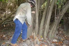
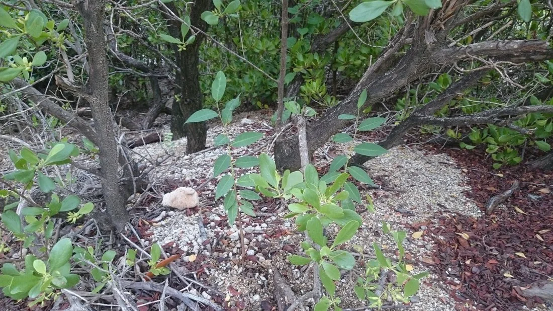
As a result, we continued to basal bark the bigger trees along the edge of the swampy areas.
As this was a continuation of last year’s project, we started on the next milestone of our pond apple project.
Liaised with local landholders along all Pond Apple areas.
The follow up covered all areas, same as last time.
We also surveyed areas to the north, south and west of each coastal Pond Apple area, to see if any new Pond Apple could be found.
Met up at the CYWAFA_INC office where we went through risk assessment, workplace health and safety, toolbox talk.
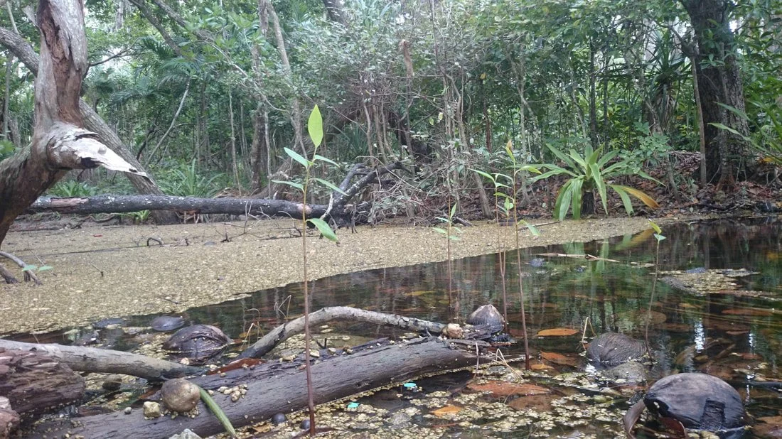
Met up at the beginning of the Pond Apple infestation behind the bakery and finished off the follow-up control work through to Chinaman Creek. We then went on to Botanic Gardens creek where we conducted 'cut stump' Pond Apple control. In the afternoon, we walked in to Cherry Tree Bay and conducted Pond Apple control by cut stump and hand pulling.
Travelled out to Walker Bay and started control work at the north end of the beach. We identified and eradicated Pond Apple seedlings sprouting from debris washed in by the tide.
We then continued the control work along Walker Bay beach until we reached the end of the swampy area.
Met up at Archers Point where we checked likely locations of Pond Apple infestations and found none.
Travelled to Alligator Creek where we conducted Pond Apple control using 'cut stump' method. Finished up in the afternoon with revision of herbicide mixing ratios and data sheet filling.
The last area to be worked on was the Mt Amos infestation.
When we got there, it was still a lot wetter than we expected.
We further surveyed the area for any pond apple that was out of water, and controlled what we could.
Managed to basal bark quite a few bigger, older trees that were on the edge of the swamp.
Mapped all of control work. The data and herbicide usage sheets were also completed.
Because it was so wet, it reduced the amount of Pond Apple area controlled.
Approximately 12ha of the existing Pond Apple area was controlled and further 42 ha of area was surveyed.
Very little was found outside of the existing areas that were surveyed.
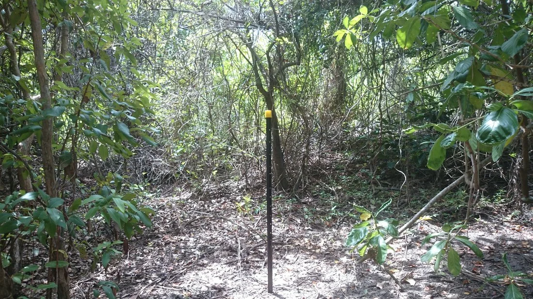
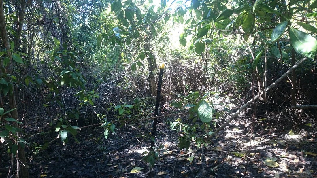
Photos were taken including photo points along the various treatment sites.
All areas of control work have been mapped using the GIS systems, and put on to QGIS maps.
The data and herbicide usage sheets were also completed.
The Pond Apple Control Program was extremely successful considering it was reasonably wet.
Trip 2 / Progress Report 07/04/2017 - 20/05/2017
We conducted a further control trip to capitalise on the gains made in the previous program.
As the swamps and all areas were drying out rapidly, the program was carried out over eighteen people days, during the above time period.
We could access most areas, except for the Mt Amos swamp area which is still very wet, with a lot of water. We will be able to access more of it later in the year, when it dries out a great deal more.
Liaised with Local Land holders along all Pond Apple areas.
The follow up covered all areas, same as last time.
We also surveyed areas to the North, South and West of each coastal Pond Apple area, to see if any new Pond Apple could be found.
Approximately 14ha of the existing Pond Apple area was controlled and further 43 ha of area was surveyed, as seedlings were found and controlled in a little bay north of Amos Bay.
We identified and eradicated Pond Apple seedlings sprouting from debris washed in by the tide.
Met up at the CYWAFA_INC office where we went through risk assessment, workplace health and safety, toolbox talk.
Started by travelling out to Walker Bay and started control work at the north end of the beach. We identified and eradicated Pond Apple seedlings sprouting from debris washed in by the tide.
Then went to the beginning of the Pond Apple infestation behind the bakery and finished off the follow-up control work through to Chinaman Creek.
We then went on to Botanic Gardens creek where we conducted 'cut stump' Pond Apple control.
We walked in to Cherry Tree Bay and conducted Pond Apple control by cut stump and hand pulling.
We then continued the control work along Walker Bay beach until we reached the end of the swampy area.
Met up at Archers Point where we checked likely locations of Pond Apple infestations and found none.
Travelled to Alligator Creek where we conducted Pond Apple control using 'cut stump' method. Finished up in the afternoon with revision of herbicide mixing ratios and data sheet filling.
The last area to be worked on was the Mt Amos infestation.
The Mt Amos swamp itself was still reasonably wet.
As a result, we continued to basal bark the bigger trees along the edge of the swampy areas.
As this was a continuation of last year’s project, we started on the next milestone of our pond apple project.
Mapped all of control work. The data and herbicide usage sheets were also completed.
Approximately 12ha of the existing Pond Apple area was controlled and further 48 ha of area was surveyed, as seedlings were found and controlled in a little bay north of Amos Bay.
Very little was found outside of the existing areas that were surveyed.
Photos were taken including photo points along the various treatment sites.
All areas of control work have been mapped using the GIS systems, and put on to QGIS maps.
The data and herbicide usage sheets were also completed.
. The mapping has been included as a part of the next control program, which will be run in after the 2017 dry season, depending on resources.
The Weeds Control Program was extremely successful, due to the fact that a smaller number of regrowth seedlings are being controlled each time.
CYWAFA_INC, Cape York NRM, and Traditional Owners, are to be commended for their professionalism and willingness to get the job done.